Research
We seek to better understand the geological processes that cycle materials and elements in the Earth system and how those processes maintain Earth's habitability. Our current research is focused on two interconnected themes: 1) sediment and landscape dynamics, and 2) the carbon cycle. We measure the compositions and fluxes of materials and fluids across scales from hillslopes to continents combining lab experiments, fieldwork, and remote sensing. The measurements help us to develop and calibrate empirical and mechanistic models to predict carbon and sediment fluxes at regional and global scales. Combining the measurements and modeling efforts helps to answer fundamental questions such as:
- How do tectonics and erosion regulate the long-term carbon cycle?
- What are the roles and functions of geomorphic systems (e.g. mountains and floodplains) in the global carbon cycle?
- How do erosional processes interplay with tectonic uplift to shape mountainous landscapes?
- Where do landslides occur and how much sediment do those landslides produce?
- How do human activities influence the carbon and sediment cycles?
- What mechanisms make the global carbon cycle maintain its balance over the long term?
- What can we learn from nature to draw down carbon from the atmosphere and sequester that carbon?
Sediment and landscape dynamics: the lifecycle of sediment and its interplay with landscapes
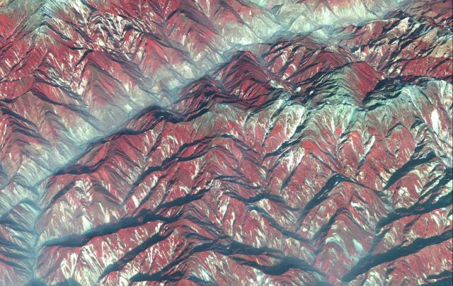
The production, transport, and deposition of sediment play a central role in shaping landscapes and driving biogeochemical cycles. Mobilization and redistribution of sediment can cause severe hazards (e.g. landslides and flooding) that are of fundamental societal importance. To better understand sediment cycles, we focus on three topics: (1) sediment production from landslides in steep mountains, (2) sediment transport in river systems, and (3) sediment budgets and landscape evolution. Those studies involve landslide mapping and analysis using remote sensing and geospatial techniques, surveys and sampling of river systems, grain size measurements in field and laboratory, and modeling work using mechanic theories. Those studies can help to constrain the magnitude of erosion in active mountain ranges, to predict the magnitudes and locations of landslides, and to understand the transport and distribution of sediment in floodplains. The image to the right shows a satellite photo wrapped on 3-D topography in the Longmen Shan mountains at the eastern margin of the Tibetan Plateau highlighting the massive landslides (light colored) after the 2008 Mw7.9 great Sichuan earthquake.
Global carbon cycle: track carbon in the Earth system
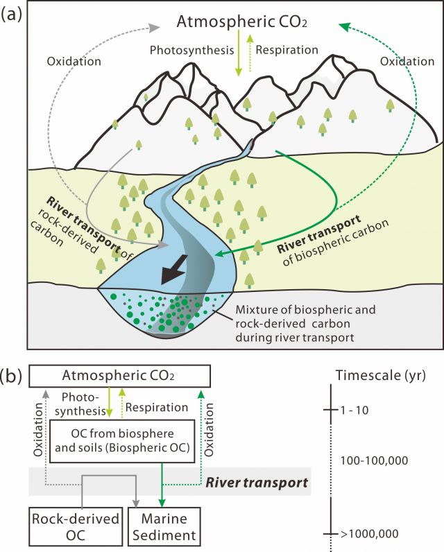
Carbon is a cornerstone element for life and fossil fuels as well as a central element making up greenhouse gases. The global carbon cycle plays a central role in the co-evolution of life and Earth systems. We are particularly interested in the long-term carbon cycle that links plate tectonics and the climate system. We study the long-term carbon cycle from three aspects: (1) the chemistry of materials carried by river systems, (2) geomorphic controls on the carbon cycle, and (3) the long-term carbon cycle models. River systems collectively integrate and transport carbon fluxes from continents to the oceans. Quantifying riverine carbon fluxes provides key constraints on the interaction between surface processes and the carbon cycle. We study carbon fluxes and budgets in large river floodplains (e.g. Yangtze) and in highly eroding settings (e.g. the eastern Tibetan mountainous rivers). We are also developing analytical approaches to measure the reactivities and age spectra of organic carbon. Those studies contribute to a better understanding of how geomorphic processes and human activities regulate the carbon cycle and provide useful information for long-term carbon cycle models. The schematic diagram to the left illustrates how rivers mobilize and transport organic carbon from different reservoirs across timescales.